
Sanatana Dharma,Hinduism was present in all ancient cultures and civilisations.
It was present in Sumerian,Minoan, Egyptian,Mayan,Inca civilisations.
One can find Archeological, Astronomical,Etymological and cultural evidence to prove this fact.
I have written on Mesoamerican civilisations and their roots in Sanatana Dharma.
What is Meso America?
‘Mesoamerica is an important historical region and cultural area in the Americas, extending from approximately central Mexico through Belize, Guatemala, El Salvador, Honduras, Nicaragua, and northern Costa Rica, and within which pre-Columbian societies flourished before the Spanish colonization of the Americas in the 15th and 16th centuries’ (wiki).
Mexico,Aztecs followed Sanatana Dharma,Caste system,Upanayana
Astabhuja ,Eight Armed Devi worshipped in Mexico
Navaratri,Rama Sits Festival in Mexico
Madurai ,India Temple design in Guatemala Chichen Itza
Hindus Yaksha city in Mexico.Mayans Tamils
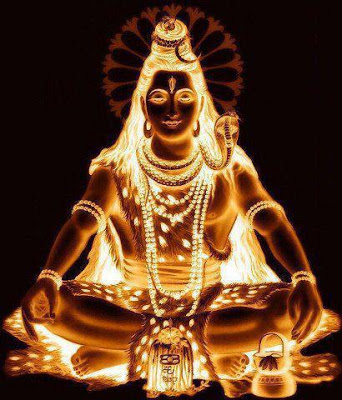
Mayan Civilization,Shiva’s Earrings,Vishnu Para ,Navagraha
Sage Kasyapa is found in all world cultures.
Temple of Makaratdwaja,son of Hanuman is found in Honduras.
Cameroonians speak Tamil ,a language of India,which is over three thousand years old.
Now more on Meso Americas.
‘
The Hindus of antiquity had an ancient astro-geographical map with four lotus petals pointing in the cardinal directions, called Mt. Meru (the world mountain). The point of the left petal fell on a seaport called Ketumala or Chetumala. Both pronunciations were used. The lower center petal was Jambudvipa (subcontinent India ).
One day, I decided to examine a map of Meso-America in order to find out whether a Chetumala or Ketumala ever existed there. It did not take me long to find out that Chetumal is even now a safe port in what is presently Belize, Central America. (See the illustrations below). The name of this port of Chetumal has never changed in all these thousands of years. According to the available evidence, I knew I had found the Chetumala depicted on the point of the left petal of the Mt. Meru drawing. But the skeptics and so-called ‘historians and mytholigists’ who are dead set against India knowing the truth about herself, for foolish reasons only they can know, insisted that the Central American Chetumal was just a coincidence. What I have never revealed to anyone until now is that the Belize Chetumal is absolutely nothing compared to the total proof you will learn in my upcoming conclusion to this article. However, my life is steadily going to its inevitable end. In order to produce fascinating articles, I have spent too much time writing anti-climaxes, while simultaneously honing my own historical skills to near perfection, building up to the time when the hero finally gets the girl. I must act now while there is still time.
See figures towards the end of the article.
You will notice that just to the left of the Chetumal petal there is a body of water called the Kashyapa Sea . A meaning of Kashyapa is ‘sea turtle; tortoise.’ We now call the Kashyapa Sea the Caribbean Sea . It is commonly known that more sea turtles of different species inhabit Meso–America and Eastern Central America than any other place in the world. One species in the region, the Hawksbill, has always been hunted for its beautiful shell which, for thousands of years, has been used to make fine ornaments. In ancient days, there were uncountable millions of Hawksbills in the Caribbean Sea . Because of centuries of feverish and constant harvesting, the Hawksville population has shrunk to an estimated 22,000 nesting females. Belize itself is a composite Sanskrit word Bala= Facing the East; The Rising Sun. Isha or Isa = God Shiva. Belize indeed faces the east.
But not even this is enough proof for those wanting to keep India hidden under the rug. So now it’s time to reveal something that no rug can ever hide. Chetumala or Ketumala is not the official name of the left petal. It is the official name of the harbor itself. The full territory was called Aparagoyana or just Goyana ( Guyana )! Apara=Western; being in the west of; a bad shore. Guh=concealed; hide; keep secret; a hiding place; filth; etc. Yana=journey; going; moving; riding; a vehicle of any kind; ship, etc. (See ancient Geography of Ayodhya, by Dr. Shyam Narain Pande; p. 8, plus 87 other references listed in the Internet.)
Aparagoyana ( Guyana ) clearly tells us that the Guhyakas and the Rakshasas were being exiled to Guyana because the civilized world was ashamed of them. Today, the name Guyana has shrunk to just the top right half of South America, but a sizable portion of the territory still retains enough of the ancient name of the left petal to let us know that the total region was in no way named Ketu Mal but Apara-Guyana. On the map itself, you will see Guyana as the first nation. The second nation’s name has been changed to Suriname, which is also derived from Sanskrit. Suri is a name of God Krishna. Nama=Named. The third one at the right is French Guiana or French Guyana.
Source. http://viewzone.com/gene.india.html


Amazing analysis and detailing🙏