Tag: Sundaland

  • Tripura Samhara Shiva Geological Kurnool Mt.Toba Proof?

    Tripura Samhara Shiva Geological Kurnool Mt.Toba Proof?

    The references found in the Vedic Texts, Vedas, Puranas and the Ithihasa ,Ramayana and Mahabharata offer three levels of understanding .

    One is that they are historical, as validated by archaeology and Carbon Dating.

    The second is that ,taking into consideration of the Theory of Circular Time, and coordinating the Quantum Theory of Multi Verse, one can say that the events mentioned in the Hindu texts are happening even now simultaneously at the three aspects of Time, Past,present and future.

    And there is the third interpretation.

    The events narrated in the Hindu texts convey abstract philosophical and Physical truths.

    It is in this context I am writing this Post.

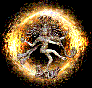
    There are references to the Tripura Samhara, The Destruction of three cities by Lord Shiva.

    As a Historical fact, there are two theories about the location of Tripura.

    One is in the Arctic and the another is in Atlantis.

    For details read here .


    The landmass we find today as  Malay Peninsula was a cluster of islands in South-East Asia.

    It consists of Malay peninsula, Java, Sumatra, Borneo and other surrounding areas.

    They were a single landmass about 22,000 years ago.

    Research by Glenn Milne and Graham Hancock have shown that these islands were not islands but were connected as a huge land mass some 22,000 years ago.

    The sea level was 150 meters lower than what we find now and hence was inhabited by people.

    This land was given the Name Sundaland.

    An ancient volcano located in Sundaland erupted about 73,000 years ago caused a wide-spread devastation of mankind and other life.
    http://www.sciencedaily.com/releases/2009/11/091123142739.htm


    Mount Toba location.image.png
    The red star on the left side of Sundaland was the location of Mt Toba, a Super Volcano that erupted then.

    The scale of devastation was such that the volcanic ash spread as far as the Arabian sea covering most parts of South India by a few meters.

    Mount Toba in ancient Map.png
    Mount Toba in ancient Map.

    The red spot in the above picture is the location of Mt Toba and the blue spots are the regions where ash deposits have been identified. Due to the wind direction at the time of eruption, the ash had spread towards west of Indonesia.

    Recent excavations in Jwalapuram, in Kurnool district of Andhra Pradesh showed that this village which had an human dwelling at that time (73,000 years ago) was covered with the ash of Mt Toba.

    Jwalapuram, Kurnool ,India.png
    Jwalapuram, Kurnool ,India.

    ‘Jwala’ in Sasnkrit means .Tongues of Flame.


    Genetic studies reveal that almost all of mankind vanished then but for a small group from which the current population of the globe has come up.

    Tripura means three sides or anything that is three. One can explain it at any level – physical, philosophical etc.
    But after coming to know of the Sunda land and the eruption of Mt Toba, the story of Tripura Samhara shows a geological event.The names associated with Tripura samhara bear unique resemblance to the way a Super Volcano was maturing to erupt.

    There was a Tarakasura who was killed by Karthikeya.
    Tara means star.
    Karthikeya is derived from a meaning ‘fire’ or ‘cut’.
    A star or star like glowing material was absorbed by Fire (Agni) is the import of this.

    After the death of  Tarakasura, his three sons,
    Tarakaksha, Vidyunmali and Makalaksha did penanceto become terrific fortresses.
    Tarakaksha means star-eyed, Vidyunmali means one wreathed in lightening and Kamalaksha means lotus eyed (red in colour).
    They formed 3 cities which were continuously rotating.
    The cities were made of iron at the bottom, silver above that and gold on top.
    They were fierce and kept rotating thereby tormenting the people.
    They were called the Tripura  Asuras.

    This description of the Tripura asuras (3 sided asuras) tallies with that of an active volcano.
    The initial Volcano, Tarakasura had spewed fire (killed by Karthikeya).
    But that was not the end of the Volcano.
    It kept being active by being star like sparks (Tarakaksha), lightening (Vidyunmali) and red in color (kamalaksha)…

    The magma underneath had been so volatile that it is described as though the 3 layers of molten minerals of iron, silver and gold were rotating all the time…

    The Danavas including Maya was present at the time Tripura was fuming!
    The torment caused by Tripura was unbearable that  the Devas asked Shiva to kill him.
    He did so by using a single arrow.
    The killing of Tripura by Shiva was described as Tripura samhara.
    The exact process of killing is described in the Sangam Tamil text called Paripadal
    which is an exact description of the destruction caused by a Volcano.

    Features of a Volcano.png
    Features of a Volcano.
    Tripura samhara visualized.
    Tripura samhara visualized.

    Paripadal – 5 says

    “naaga naaNaa malai villaaka
    moovagai, aareyil Orazal ambin muLiya”
    (நாக நாணா மலை வில்லாக
    மூவகை ஆரெயில் ஓரழல் அம்பின் முளிய)

    Naaga – snake
    naaNaa – as the string (of the bow)
    malai – mountain
    villaaka – as the bow
    moovakai – 3 types
    aareyil – walls (fortresses)
    Orazal – a single streak of fire
    ambin muLiya – at the end of an arrow – killed

    That is,
    Shiva killed Tripura with the mountain as the arrow and the snakes (mantle / magma) as the string, he blew the 3 fortresses of iron, silver and gold (molten material) by shooting a single arrow which has fire at its end.
    The snakes – as we told before – personify the magma trying to come out.

    This describes the sudden and powerful eruption of fire and mantle from inside the mountain (volcano) which resulted in the complete collapse of the volcano.

    To depict it pictorially, here is the image of how a volcano looks when it bursts.

    Sundaland.

    Sundaland (also called the Sundaic region) is a biogeographical region of Southeastern Asia which encompasses the Sunda shelf, the part of the Asian continental shelf that was exposed during the last ice age. The last glacial period, popularly known as the Ice Age, was the most recent glacial period within the current ice age occurring during the last years of the Pleistocene, from approximately 110,000 to 12,000 years ago. It included the Malay Peninsula on the Asian mainland, as well as the large islands of Borneo,Java, and Sumatra and their surrounding islands. The eastern boundary of Sundaland is the Wallace Line, identified by Alfred Russel Wallace as the eastern boundary of the range of Asia’s land mammal fauna, and thus the boundary of the Indomalaya and Australasia ecozones. The islands east of the Wallace line are known as Wallacea, and are considered part of Australasia.

    Citation and reference.

    http://en.wikipedia.org/wiki/Sundaland

    http://jayasreesaranathan.blogspot.in/2011/11/sundaland-was-location-of-tripura.html

  • Poompuhar Find Sets Tamil,Hinduism By Atleast 20000 Years

    Recently I wrote an article stating that 11000 Years Old Tamil Port Poompuhar confirms Manu Migration.

    Reaction to this post has been amazing and I have been asked to elaborate further as this is a very serious issue concerning the Dates of Tamil and Sanatana Dharma.

    Poompuhar remains underwater.jpg.
    Poompuhar remains underwater.

    I am normally regarded as being Parochial to Hinduism Sanatana Dharma and called as one who is against Tamil.

    I am neither,I simply produce evidence as they are.

    The Tamil sites who have been calling me names have now been sending mails to me requesting to publish more articles on the antiquity of Tamil!

    This after my recent articles on Tamil and Sanskrit.

    Well I shall continue to write facts as they are available, relying more on Indian Literature ,Epigraphy, Linguistics rather than some big fancy Names of self-styled Indologists.

    Now on the find of the material being dated 11000 Years  sets the Tamil History and the Sanatana Dharma back at least by 20,000 years.https://youtu.be/Vi6IJbZe2YE

    But the Tamil Sangams are dated at

    “that the first two of which were held in cities since “taken by the sea”, and the third of which was held during the 5th century BC in the present-day city of Madurai.'(wiki).

    Silappadikaram  has been dated to likely belong to the beginning of Common era.

    The incidence of Kovalan Madhavi and Kannagi took place in the same period as the poet who wrote the Tamil Epic was the brother of the Chera King Cheran Senguttuvan.

    However the recent finding placed these dates to 11000 years back!

    So it is logical to arrive at the conclusion that the Silappadikaram Town was in existence around 11000 CE and for a rich language as Tamil to develop, from a dialect, colloquial form and then to literary ,it requires  minimum  5000 Years.

    And Tamil quotes Ithihasas ,Ramayana and Mahabharata and the Vedas.

    That should place these Ithihasas earlier .

    Hence based on this evidence available now, Tamil should be at least 16000 years old and the Sanskrit Puranas earlier.

    Please read my Post Million Year Old Tamil quotes Vedas and they quote Tamil.

    But we are assigning Tamil Sangam at 500 BC and Rig veda at 5000 BC!

    Sundaland Image.bmp
    Sundaland.

    The date of Poompuhar artifact was arrived at and verified by  Glenn Milne Sea Level changes.

    The place is called Poompuhar. It lies on southeast India’s Coromandel coast facing the Bay of Bengal between modern Tamil Nadu and Sri Lanka. Its immediate offshore area has been the subject of marine archaeological investigations by India’s National Institute of Oceanography since the 1980’s — and numerous non-controversial finds of man-made structures dated between the third century AD and the third century BC have been made in the “inter-tidal zone” close to shore at depths down to 6 feet (approximately 2 metres).

    These finds of structures in shallow water (some so shallow that they are exposed at low tide) have been quite widely written-up in the archaeological literature. But for some reason other discoveries that the NIO has made in deeper water off Poompuhar have attracted no attention at all. Most notably these other discoveries include a second completely separate group of structures fully three miles from the Poompuhar shore in water that is more than 70 feet (23 metres) deep. The lack of interest is surprising because to anyone with even minimal knowledge of post-glacial sea-level rise their depth of submergence is – or should be – highly anomalous. Indeed according to Glenn Milne’s sea-level data the land on which these structures were built last stood above water at the end of the Ice Age more than 11,000 years ago.

    Is it a coincidence that there are ancient Tamil flood myths that speak of a great kingdom that once existed in this area called Kumari Kandam that was swallowed up by the sea? Amazingly the myths put a date of 11,600 years ago on these events — the same timeframe given by Plato for the end of Atlantis in another ocean.

    Like the cities in the Gulf of Cambay the underwater structures three miles offshore of Poompuhar were first identified by an instrument called sidescan sonar that profiles the seabed. One structure in particular was singled out for investigation and was explored by divers from India’s National Institute of Oceanography in 1991 and 1993. Although they were not at that time aware of the implications of its depth of submergence — i.e. that it is at least 11,500 years old — the 1991 study confirms that it is man-made and describes it as:

    a horse-shoe-shaped object, its height being one to two metres. A few stone blocks were found in the one-metre wide arm. The distance between the two arms in 20 metres. Whether the object is a shrine or some other man-made structure now at 23 metres [70 feet] depth remains to be examined in the next field season.

    The 1993 study refines the measurements:

    The structure of U-shape was located at a water depth of 23 metres which is about 5 kilometres off shore. The total peripheral length of the object is 85 metres while the distance between the two arms is 13 metres and the maximum height is 2 metres Divers observed growth of thick marine organism on the structure, but in some sections a few courses of masonry were noted.

    Graham Hancock is an advocate of this theory and I subscribe to this as this has more science to back it up.

    The Glenn Milne Theory of Sea Level Change places a landmass Sundaland.

    Sundaland was a cluster of islands in South consisted of Malay peninsula, Java, Sumatra, Borneo and other surrounding areas.

    The recent developments in sea level research done by Glenn Milne and Graham Hancock have shown that these islands were not islands but were connected as a huge land mass some 22,000 years ago.

    ‘The sea level was lower than now by approximately 150 meters thereby offering a good expanse of land for mankind to thrive. This region is a centre of attraction for researchers because this is the “closest area” for early man from east Africa who moved out eastward around one lakh years ago…

    Exposed Land Mass of Sundaland.image.png
    Exposed Land Mass of Sundaland

    The light shades around the continents show the extent of exposed landmass at an earlier time when sea level was low due to Ice Age. The red circle shows the ‘Sundaland’ which now looks fractured into islands. The migration of man as revealed in genetic studies show that mankind stayed on for thousands of years  somewhere in the Indian Ocean. Currently Indian Ocean, south off India shows no sign of landmass. But with the discovery of Sundaland, there is increased interest in finding out whether it offered habitation for early man.

    How this Landmass was destroyed,By A Volcano.

    A New study provides “incontrovertible evidence” that the volcanic super-eruption of Toba on the island of Sumatra about 73,000 years ago deforested much of central India, some 3,000 miles from the epicenter, researchers report.a The volcano ejected an estimated 800 cubic kilometers of ash into the atmosphere, leaving a crater (now the world’s largest volcanic lake) that is 100 kilometers long and 35 kilometers wide. Ash from the event has been found in India, the Indian Ocean, the Bay of Bengal and the South China Sea.

    Citations.

    http://www.sciencedaily.com/releases/2009/11/091123142739.htm

    http://jayasreesaranathan.blogspot.in/2011/11/sundaland-was-location-of-tripura.html

    http://www.grahamhancock.com/archive/underworld/underworld1.php?p=4